Idaho Hunt Planner We got game.
Hunt Area
All of Units 19A, 22, 23, 24, 25, 31, 32 and 32A.
More information about the Game Management Unit(s) in this area: 19A 22 23 24 25 31 32 32A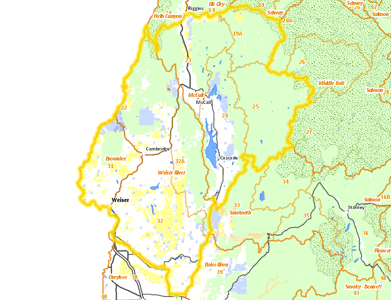
Surface Management
For government land, these data show the managing agency of the land, which may or not be the same as the owning agency.
 U.S. Forest Service (USFS) 48.36%
|
|
Private 35.23%
|
|
U.S. Bureau of Land Management (BLM) 10.01%
|
|
State of Idaho 5.24%
|
|
Other 0.37%
|
|
U.S. Bureau of Reclamation (BOR) 0.33%
|
|
State of Idaho 0.27%
|
|
State of Idaho 0.04%
|
|
U.S. National Wildlife Refuge (NWR) 0%
|
Make your own map of Hunt Area
Ownership data source: Inside Idaho
Access Yes! Properties
Access Yes! is Fish and Game program designed to improve hunting and fishing access to private land or through private land to public land by compensating willing landowners who provide access.
Forest Service Land
Check for road and area closures on National Forest websites
- Boise National Forest
- Nezperce National Forest
- Payette National Forest
- Salmon-Challis National Forest
Federally-designated Wilderness Areas
No motorized vehicles are allowed in these areas.
- Frank Church - River of No Return Wilderness 54,739 acres (1.32% of hunt area)
- Hells Canyon Wilderness 29,844 acres (0.72% of hunt area)
Land Use/Land Cover
|
Forest
57.27
%
|
|
Rangeland
34.75
%
|
|
Irrigated-Gravity Flow
5.68
%
|
|
Irrigated-Sprinkler
0.98
%
|
|
Water
0.62
%
|
|
Riparian
0.45
%
|
|
Urban
0.18
%
|
|
Dryland Agriculture
0.07
%
|
Make your own map of Hunt Area
Land Use data source: IDWR
Towns in this Hunt Area
- Payette, US 95 Idaho 52
- Emmett, Idaho 52
- Weiser, US 95
- McCall, Idaho 55
- Cascade, Idaho 55
- Horseshoe Bend, Idaho 55 Idaho 52
- Council, US 95
- New Meadows, US 95 Idaho 55
- Riggins, US 95
- Cambridge, US 95
- Yellow Pine, East Fork Rd.
- Warm Lake, Warm Lake Rd.