Idaho Hunt Planner We got game.
Hunt Area
That portion of Unit 1 within the following boundary: Beginning at the Idaho/Washington state line where it intersects the Pend Oreille River, then northward along the Idaho/Washington state line to the Lamb Creek drainage, then southeasterly along the northern edge of the Lamb Creek divide to Priest Lake, then along the southern shore of Priest Lake to the Soldier Creek drainage, then easterly along the northern edge of the Soldier Creek drainage to the Selkirk Divide, then southerly along the Selkirk Divide to Baldy Mountain, then easterly along Little Sand Creek to the Pend Oreille River, then westerly along the northern shore of the Pend Oreille River to the point of beginning AND that portion of Unit 1 within the following boundary: Beginning at the confluence of the Moyie River and the Kootenai River, then west and north on the Kootenai River to the Copeland Bridge, then east on County Road 45 to the junction with State Hwy 1, then south on State Hwy 1 to the intersection with State Hwy 95, then north and east on State Hwy 95 to where State Hwy 95 crosses the Moyie River, then south on the Moyie River to the point of beginning.
More information about the Game Management Unit(s) in this area: 1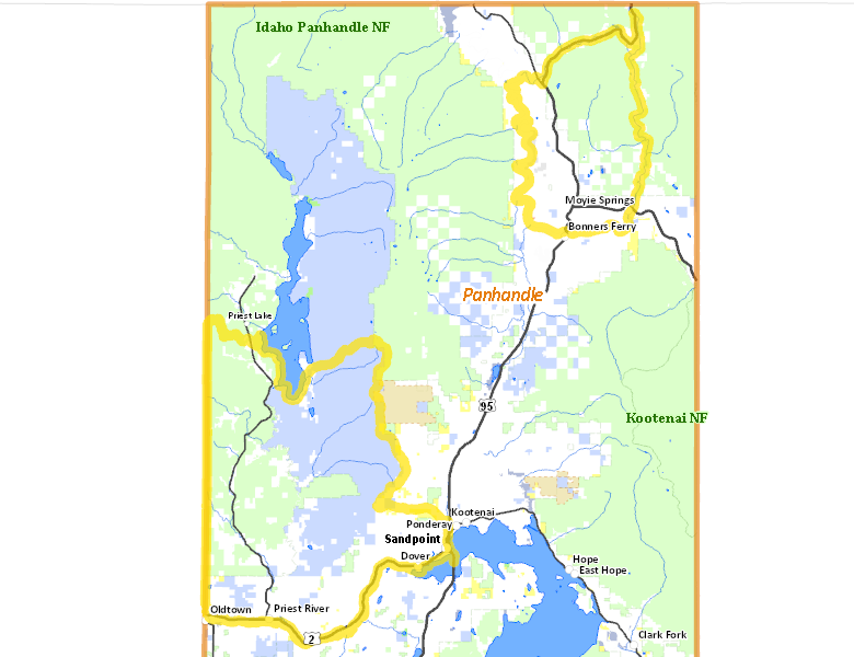
Surface Management
For government land, these data show the managing agency of the land, which may or not be the same as the owning agency.
 Private 39.3%
|
|
U.S. Forest Service (USFS) 34.47%
|
|
State of Idaho 24.43%
|
|
Other 0.75%
|
|
U.S. Bureau of Land Management (BLM) 0.58%
|
|
Indian Reservation / Bureau of Indian Affairs 0.38%
|
|
State of Idaho 0.06%
|
|
State of Idaho 0.01%
|
|
Indian Reservation / Bureau of Indian Affairs 0.01%
|
Make your own map of Hunt Area
Ownership data source: Inside Idaho
Access Yes! Properties
Access Yes! is Fish and Game program designed to improve hunting and fishing access to private land or through private land to public land by compensating willing landowners who provide access.
No properties are currently available in .
View all Access Yes Participants.
Forest Service Land
Check for road and area closures on National Forest websites
Federally-designated Wilderness Areas
No motorized vehicles are allowed in these areas.
There are no wilderness areas in .
Land Use/Land Cover
|
Forest
75.49
%
|
|
Dryland Agriculture
19.91
%
|
|
Rangeland
3.81
%
|
|
Urban
0.52
%
|
|
Water
0.27
%
|
Make your own map of Hunt Area
Land Use data source: IDWR
Towns in this Hunt Area
- Sandpoint, US 95 US 2 Idaho 200
- Bonners Ferry, US 95
- Priest River, Idaho 57 US 2