Idaho Hunt Planner We got game.
Hunt Area
That portion of Unit 22 as follows: Beginning at the junction of U.S. 95 and the West Fork Weiser River Road (FR 127), then north on FR 127 to Grouse Creek Road (FR 123), then northwest on FR 123 to the watershed divide between Lick Creek and Lost Creek drainages, then north on the divide between Lick Creek and Lost Creek drainages to Lick Creek Lookout, then east along Unit 22 boundary to U.S. 95 to the point of beginning.
More information about the Game Management Unit(s) in this area: 22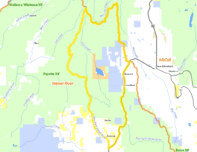
Surface Management
For government land, these data show the managing agency of the land, which may or not be the same as the owning agency.
 U.S. Forest Service (USFS) 65.49%
|
|
State of Idaho 15.1%
|
|
Private 13.31%
|
|
U.S. Bureau of Reclamation (BOR) 3.95%
|
|
U.S. Bureau of Land Management (BLM) 2.15%
|
Make your own map of Hunt Area
Ownership data source: Inside Idaho
Access Yes! Properties
Access Yes! is Fish and Game program designed to improve hunting and fishing access to private land or through private land to public land by compensating willing landowners who provide access.
No properties are currently available in .
View all Access Yes Participants.
Forest Service Land
Check for road and area closures on National Forest websites
Federally-designated Wilderness Areas
No motorized vehicles are allowed in these areas.
There are no wilderness areas in .
Land Use/Land Cover
|
Forest
93.15
%
|
|
Irrigated-Gravity Flow
4.33
%
|
|
Rangeland
1.73
%
|
|
Water
0.57
%
|
|
Irrigated-Sprinkler
0.22
%
|
Make your own map of Hunt Area
Land Use data source: IDWR
Towns in this Hunt Area
No services are available inside .
Services courtesy of the Official Idaho Travel and Tourism Guide